This week, I took my camera along and tried to capture some of these relationships by photo. But first, I'd like to give you a better idea of where the waterfront is located. The first map shows the SF Bay area...

This second map shows the waterfront park up close - the dots and numbers correspond to where I took the photos.
This first photograph captures the tension between Beauty/Water/Solitude and Traffic/Busy/Noise. There is a sandy beach, waves gently crashing into the rocks with industrial fragments/waste and a freeway lingering in the horizon. The noise is inescapable.
The next two photos symbolize growth versus decay. Both are happening at once. Bricks poke up out of the ground as you walk... Concrete chunks sit in the water... yet both are surrounded by green, growth and vitality.


I was very surprised (though in retrospect I should have not been) to see people secretly living on the waterfront. Some of the side trails led past several tents. People claim some of the land as their own and carve out their unique space. I didn't take many photos because I felt intrusive. Thankfully it was early in the morning and nobody really seemed to be awake.

Visitors, on the other hand, were primarily dog walkers/joggers. They didn't venture too far out onto the peninsula - perhaps they had previously wandered too far as I had.

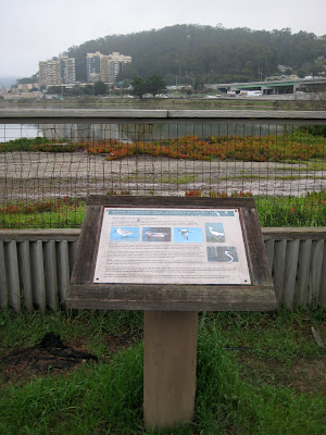
A large part of the waterfront is fenced off for restoration projects. One of the photos below shows signs put up along the beginning of the fence. A wood fence is only used near the entrance - it soon turns into the standard metal wire/chain link.
This photo shows two paths - I noticed this as I was walking out, back to my own neighborhood. The path to the left, unpaved, belongs to the restoration while the path to the right, manicured and mowed, belongs to the neighboring racetrack. I find it ironic that there are two paths right next to each other. Did the racetrack decide to just ignore the existing path in an attempt to pretend it didn't exist?

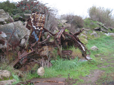
As I wandered further out I found larger piles of waste, including bundles of twisted metal, molding stretches of carpet, and discarded insulation. At the tip of the peninsula I found sculptures (made by visitors or residents?). This perfectly represented the tension between sculpture and junk. To one it is merely a medium for creative expression, to another it symbolizes the end of an idea.


No comments:
Post a Comment